
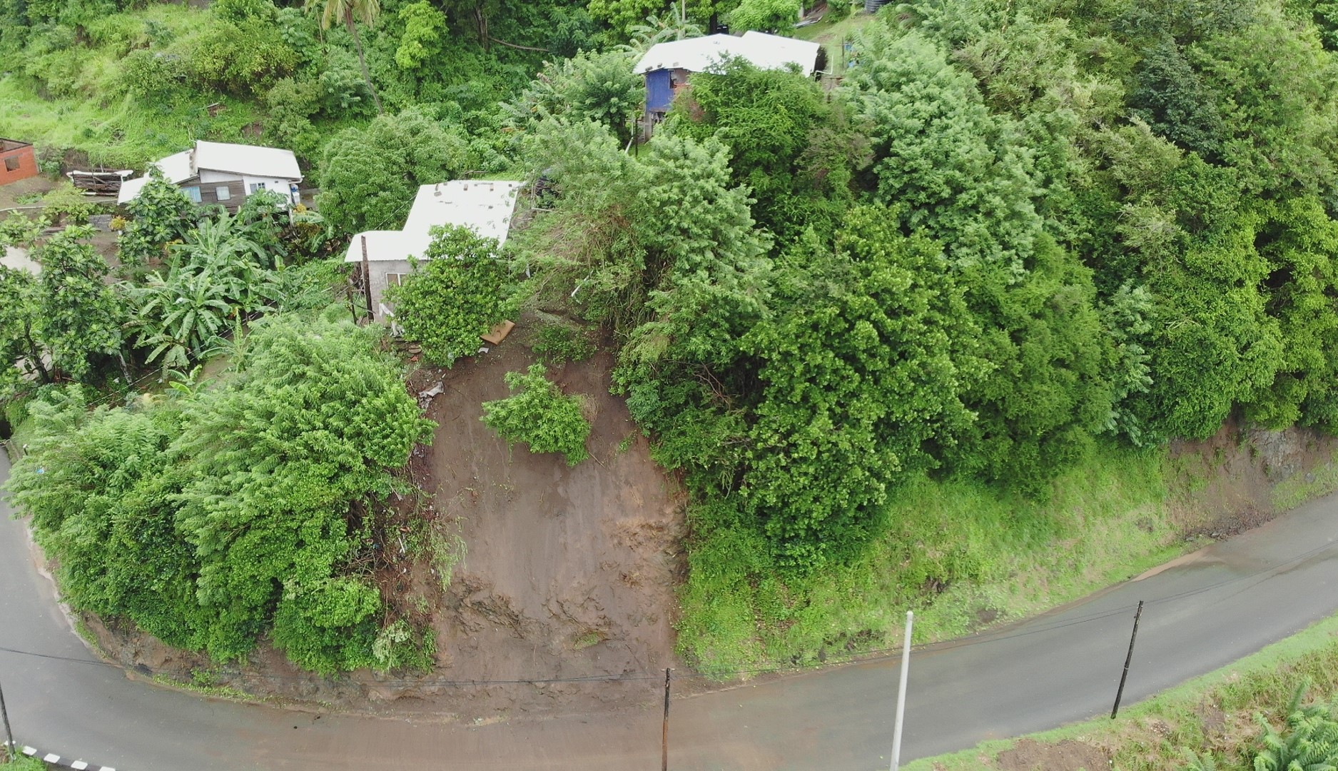
2022 (Image 24) Aerial Photography of Bad Rock
Aerial photography of Bad Rock located in 26-12 Windward Road, Belle Garden, St. Paul, Tobago for October 2022. The image is 861 KB on disk and has a dimension of 1875 x 1080.
其他資訊
| 欄位 | 值 |
|---|---|
| 最後更新資料 | 五月 3, 2024 |
| 最後更新的詮釋資料 | 五月 3, 2024 |
| 建立 | 五月 3, 2024 |
| 格式 | image/jpeg |
| 授權 | Creative Commons Attribution |
| created | 超過 1 年之前 |
| format | JPEG |
| has views | True |
| id | 2b108744-bbcb-4b17-9b5b-3aea2d233433 |
| last modified | 超過 1 年之前 |
| mimetype | image/jpeg |
| on same domain | True |
| package id | c59b2518-d3de-4ef5-b6aa-cd00fda3711d |
| position | 24 |
| revision id | fac6cf66-c42a-459c-9763-4dce73cd47b4 |
| size | 861.3 KiB |
| state | active |
| url type | upload |